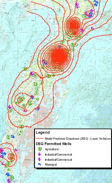
Ground Water Model
Since 2003, the Committee has had an agreement with the USGS to develop and calibrate a ground water model for the Eastern Shore of Virginia. The major focus of the model is simulation of water levels in the various aquifers and simulation of chloride concentrations.