Working Waterfronts
Eastern Shore Definition of “Working Waterfronts”
(as adopted by the A-NPDC in 2012)
Real property (including support structures over and adjacent to the water or inland property engaged in significant water-related activities) that provides access to coastal waters or that supports commercial fishing; recreational fishing businesses; aquaculture; ecotourism; national defense; public safety uses; marine research; shipping and rail yards; boat building; support of offshore energy production; or other commercial, recreational, and industrial businesses.
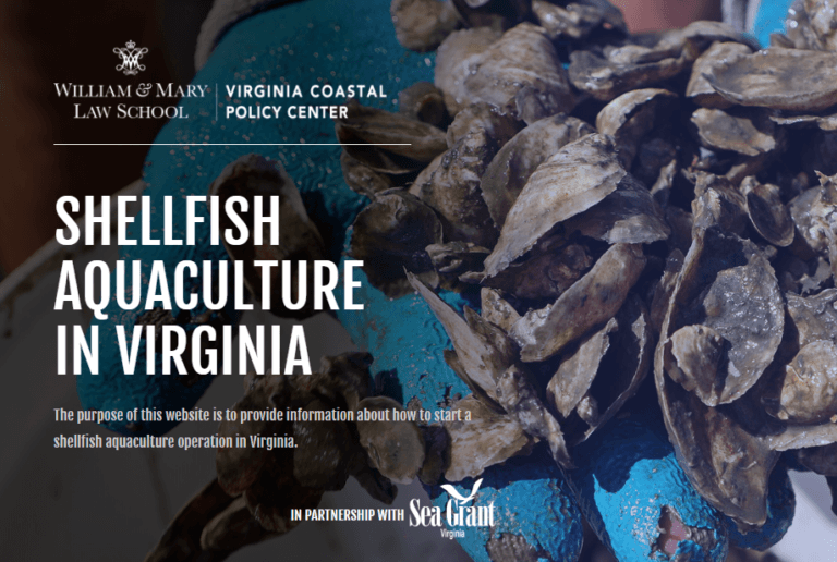
Interested in starting your own aquaculture shellfish operation in Virginia?
Be sure to check out the Virginia Coastal Policy Center (VCPC) – in partnership with Sea Grant Virginia – NEW Aquaculture Tool by clicking on the image below!
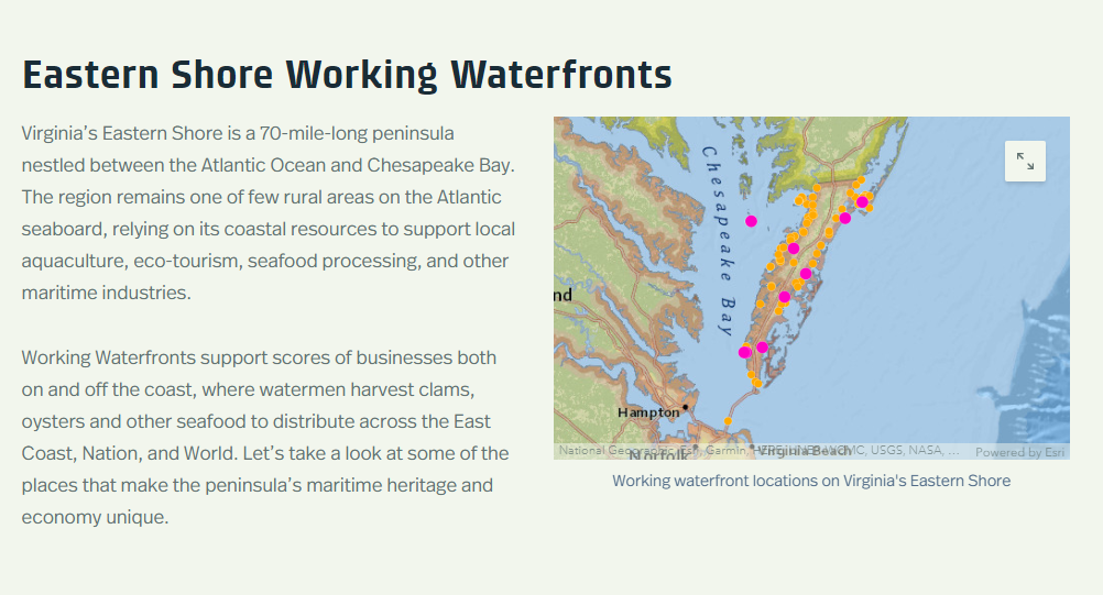
Click on the Preview Above to see the Eastern Shore Working Waterfronts Story Map (also linked here)
The Eastern Shore, Middle Peninsula and Northern Neck, with the assistance of the Virginia Coastal Zone Management Program, have issued a video and companion story map highlighting local marine and seafood businesses across the three regions.
Middle Peninsula Working Waterfronts Story Map
Northern Neck Working Waterfronts Story Map
The Rural Chesapeake Bay – Seaside Working Waterfront Coalition Ensures the sustainability of Virginia’s working waterfronts and related industries. Supported by the Virginia Coastal Zone Management Program. A Working Waterfronts Master Plan including actions to help preserve working waterfronts has been published. For more information and a summary of accomplishments visit DEQs page on working waterfronts.

Working Waterfront Products and Documents
2019 – Rural Coastal Virginia Community Enhancement Authority Summit convened representatives from the region to address shared challenges and opportunities. The summit presentation included topics such as cost savings for commercial projects, resilience needs, and the use of living shorelines and nature-based approaches.
2018 – Coastal Living in Virginia Rack Card for the general public and new or potential residents and 4-page Working Waterfront Management Guidance Document for planners, administrators, or elected officials. Final report produced for the Virginia Coastal Zone Management Program.
2017 – National Working Waterfront Network Toolkit
2016 – Virginia Working Waterfront Master Plan
Virginia Working Waterfront Master Plan 2-Page Summary
Master Plan Summary Presentation
Eastern Shore of Virginia Regional Dredging Needs Assessment
2015 – Case Study of Willis Wharf Working Waterfront: Zoning and Property Ownership Issues
2014 – Virginia Working Waterfronts Workshop: A Sense of the Symposium
Economic Activity Associated with Commercial Fisheries and Shellfish Aquaculture in Northampton County, Virginia (VIMS Study)
2013 – Eastern Shore Working Waterfront Inventory
Eastern Shore Working Waterfront Overview
Rural Chesapeake Bay/Seaside of Virginia Working Waterfront Coalition Report – includes case studies of impacts upon existing and former Eastern Shore working waterfronts
Project Background
The A-NPDC began its Working Waterfront Initiative to preserve and enhance working waterfronts in its region in 2012. The first steps of this initiative were to develop baseline datasets and identify needs. As part of its Coastal Resource Program Technical Assistance Grant from the Virginia Coastal Zone Management Program (VCZMP) and NOAA, the A-NPDC conducted a needs assessment for transient boating facilities in the region. Soon thereafter, the A-NPDC, Northern Neck PDC, Hampton Roads PDC, and Middle Peninsula PDC partnered on a VCZMP/NOAA grant to map and inventory working waterfronts in their respective jurisdictions and to organize a summit in 2014 to present their findings and recommendations for tools that have potential for preserving working waterfronts. After conducting these baseline assessments, the A-NPDC conducted case studies of working waterfront facilities that had recently ceased operations or were under significant economic duress VCZMP/NOAA funds in 2013 and conducted an additional case study looking into impacts of local ordinances and policies upon current working waterfronts in 2015. During 2016, the A-NPDC and other coastal regions worked with the VCZMP and other industry and government partners to develop the Virginia Working Waterfronts Master Plan, which is the first plan of its kind in the nation and has set the stage for numerous strategies that will work to both preserve, protect, and enhance working waterfronts in the Commonwealth.
History of Working Waterfronts in the Region
Before the advent of the railroad in 1884, almost all commerce on the Eastern Shore of Virginia was conducted by water. There were few interior roads. Many more working waterfronts existed in the 18th and 19th centuries, and most large farms on both the bayside and seaside had their own docks for shipping goods out to market, as well as off-loading seafood.
Numerous small towns had access to the Chesapeake Bay and the Atlantic Ocean via tidal creeks. Many of these creek landings have since silted in due to changes in land-use practices during the 19th and 20th Centuries, and others have been inundated due to rising water levels or shoaled in by storms over time as funding to dredge them became unavailable.
Tons of oysters were hand-tonged, patent-tonged, or dredged. By the turn of the 20th century, 10 million bushels of oysters were harvested and sent to market. All had to be off-loaded at the numerous working waterfronts situated on the shoreline. Sawmills made barrels in which to pack the catch, and icehouses in Cape Charles and Tasley provided the ice needed to keep it fresh. In addition, commercial fish landings were huge until the 1950’s. Commercial fishing continues today, but at a much smaller scale.
Blue crabs were packed in ice and shipped via steamer to Baltimore and Washington, as they are extremely perishable. Oysters were shipped as well, but many oysters were bound for New York City, where 100 years ago consumption of oysters was almost unbelievable by present-day standards. In New York City, the average was eight bushels per year or five oysters per day for every man, woman and child in the city of under 900,000 people (McHugh, J. L. p 49).
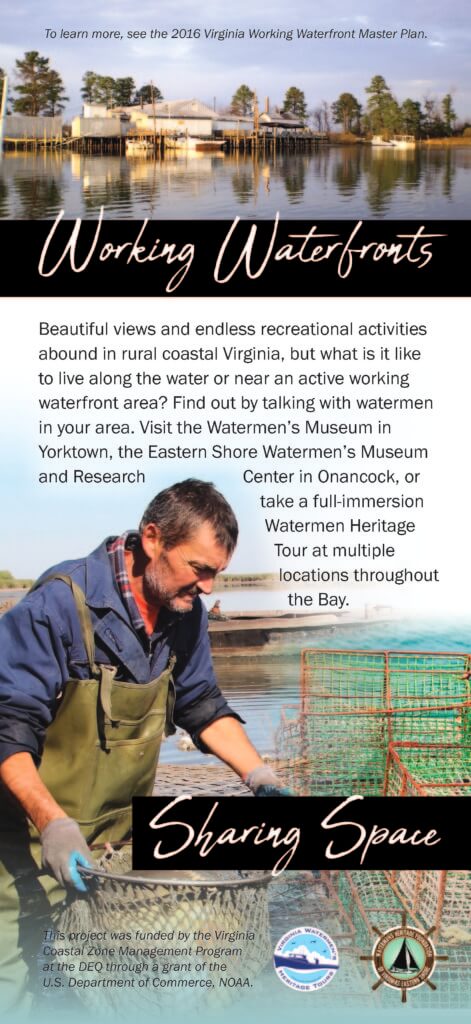
Today, working waterfronts on the Eastern Shore continue to be used to offload fish and shellfish, to use seed clam and oyster spat, recreational fishing vessels meet their clients, buying stations are located, shellfish are processed, and many serve as home ports for commercial fishermen and aquaculture businesses. Although working waterfronts have declined in number in the 20th and 21st centuries, the A-NPDC identified more than 200 sites that are still actively engaged as working waterfronts on the Eastern Shore of Virginia.
Working Waterfronts Steering Committee Meeting Packets & Minutes
- October 30, 2018 Agenda and Minutes
- June 21, 2018 Agenda and Minutes
- January 31, 2018 Agenda & Packet and Minutes
- January 9, 2018 Agenda & Packet and Minutes


